Landforms:
There are several volcanic mountain ranges located in Luzon. In the northern region on the island, there is Cordillera Central. In the east there is the Sierra Madre and in the central western coast of the island there are the Zambales Mountains. Luzon is home to the highest number of active volcanoes in the Philippines, with 28 volcanoes in total.
These include the Bulusan Volcano, Pocdol Mountains, Taal Volcano, Mayon Volcano, Malindig Volcano, Masaraga Volcano, Malina Volcano, Iriga Volcano, Panay Volcano, Isarong Volcano, Banahaw Volcano, Labo Volcano, Arayat Volcano, San Pablo Volcano,Ambalatungan Volcano, Laguna Volcano, Makiling Volcano, Natib Volcano, Pinatubo Volcano, Mariveles Volcano, Cagua Volcano, Patoc Volcano, Binuluan Volcano, Amorong Volcano, and Santo Tomas Volcano.

Located in the Bicol Peninsula of the island lies an active volcano known as the Mayon Volcano. It is extremely well known for being a symmetrical stratovolcano and is one of the most active ones in the world. It often has pyroclastic eruptions that lead to large evacuations due to ash, mud flows, and lava. |

Mount Pulag is the highest peak of Luzon, and the second highest in the Philippines. It is approximately 2922 meters above sea level. It is home to a large amount of biodiversity and is home to several endangered spieces such as the philippine deer and the long-haired fruit bat. Today, a part of the mountain is reserved as a national park. A common tourist attraction are the sea of clouds and its hiking trails are usually occupied by international hikers.
|
The Zambales Mountains extend from north to south and divide Luzon's central plains from the East China Sea. The mountain range is of volcanic origin, however the only active volcano in the range is Mt. Pinatubo. These mountains are rich in minerals and often have forest filled slopes.

|
Taal lake is a fresh-water, crater lake in which Taal Volcano rises. It also contains another crater lake. Taal volcano, also known as volcano island, is one of the most dangerous volcanoes in the Philippines. The lake partially fills the Taal Caldera, which was created due to prehistoric eruptions. With is close proximity to the capital (50 km) and people, it often cause extreme damage. It is known as "an island within a lake on an island within a lake on an island." |
bodies of water:
Both the largest lake in the Philippines and the longest river are located in Luzon. Laguna de Bay is the largest lake in the Philippines and is located southwest of Manila. The Cagayan river located in north-central Luzon is the longest river in the Philippines. Taal Lake, located south of Manila as well, occupies a volcanic crater that holds a volcano island with its own volcanic crater. Other rivers located in Luzon include; the Agno, Chico, Pasig, Abra, Bicol, and Pamanga. Agno and Abra both cross the Central Luzon Valley and the Chico River is used to irrigate mountainside rice fields. The Pasig flows through Manila and is used for commercial means.

Bicol River
|
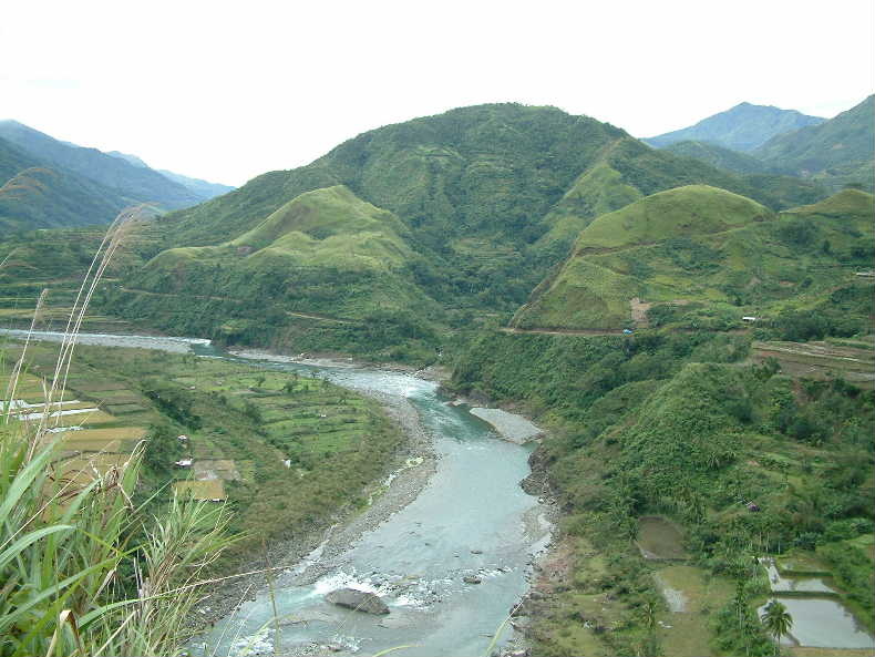
Chico River
|
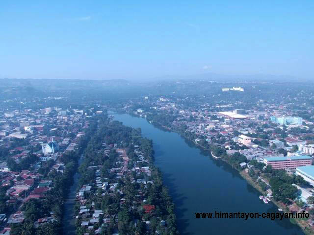
Cagayan River
|
